Quick Answer
Pinellas County is one of the most flood-vulnerable counties in the United States.
Sitting on a narrow peninsula between Tampa Bay and the Gulf of Mexico, roughly 50 to 60 percent of Pinellas County falls within a FEMA Special Flood Hazard Area. Every buyer here needs to understand their property’s flood zone designation before signing a contract, because it directly affects insurance costs, building requirements, and resale value.
Key Takeaways
- Pinellas County has six common FEMA flood zones: A, AE, V, VE, X (shaded), and X (unshaded), each with different risk levels and insurance requirements
- Check your flood zone for free at the FEMA Flood Map Service Center or the Pinellas County GIS portal
- Flood insurance is mandatory for federally backed mortgages in high-risk zones (A, AE, V, VE) and strongly recommended everywhere else
- FEMA’s Risk Rating 2.0 now prices policies by individual property risk, not just zone designation
- Florida law requires sellers to disclose flood zone status, insurance history, and known flooding to buyers
In This Guide
- What Are the Flood Zone Types in Pinellas County?
- How Do You Check Your Flood Zone?
- Why Is Pinellas County So Vulnerable to Flooding?
- What Does Flood Insurance Cost in Pinellas County?
- How Does FEMA’s Risk Rating 2.0 Affect Homeowners?
- What Is an Elevation Certificate?
- What Are Florida’s Flood Disclosure Requirements?
- What Should Buyers Know Before Purchasing in a Flood Zone?
- Frequently Asked Questions
If you’re looking at Pinellas County real estate, flood zones are not optional homework. They’re the single biggest factor most buyers overlook until it’s too late.
After 23+ years in real estate, I can tell you this: the buyers who understand flood zones before they start shopping make better decisions, negotiate smarter, and avoid expensive surprises at closing. This guide covers everything you need to know about Pinellas County flood zones, from the FEMA designations to what they actually mean for your wallet.

What Are the Flood Zone Types in Pinellas County?
FEMA assigns flood zone designations based on how likely an area is to flood in any given year. Here’s what you’ll encounter across Pinellas County:
| Zone | Risk Level | What It Means | Insurance Required? |
|---|---|---|---|
| A | High | 1% annual flood chance (100-year floodplain). No base flood elevation established. | Yes |
| AE | High | Same 1% chance, with a specific base flood elevation (BFE) on the map. Most common high-risk zone in Pinellas. | Yes |
| V | Very High | Coastal high-hazard area with wave action. Rare in Pinellas since most coastal areas have detailed mapping. | Yes |
| VE | Very High | Coastal high-hazard with waves 3+ feet and established BFE. Found along Gulf beaches and barrier islands. | Yes |
| X (shaded) | Moderate | 500-year floodplain. Not required by lenders, but roughly 25% of all NFIP claims come from X zones. | No, but recommended |
| X (unshaded) | Low | Minimal risk. Higher-elevation inland areas like parts of Seminole, Largo, and Pinellas Park. | No |
Zone AE covers the largest portion of Pinellas County’s high-risk areas, running along Tampa Bay’s shoreline, around Lake Seminole, and through low-lying inland neighborhoods. Zone VE is concentrated on the barrier islands from Clearwater Beach down through St. Pete Beach and Pass-a-Grille, where storm surge and wave action pose the greatest threat.
One thing I tell every buyer: being in Zone X does not mean your property won’t flood. It means the statistical probability is lower. In a county shaped like Pinellas, water finds a way.
How Do You Check Your Flood Zone in Pinellas County?
Checking your flood zone is free and takes about two minutes. Here are the three best tools:
- FEMA Flood Map Service Center (msc.fema.gov): Enter any address to see the official Flood Insurance Rate Map (FIRM). This is the definitive, legally binding source.
- Pinellas County GIS Portal (egis.pinellas.gov): Toggle on the flood zone layer to see an interactive overlay for any parcel in the county.
- Pinellas County Property Appraiser (pcpao.gov): Property records often reference flood zone designations alongside tax and ownership data.
Keep in mind that the free FEMA lookup shows your zone designation, but it won’t show your property’s actual elevation compared to the base flood elevation. For that, you’ll need an elevation certificate from a licensed surveyor.
Why Is Pinellas County So Vulnerable to Flooding?
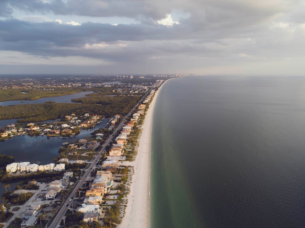
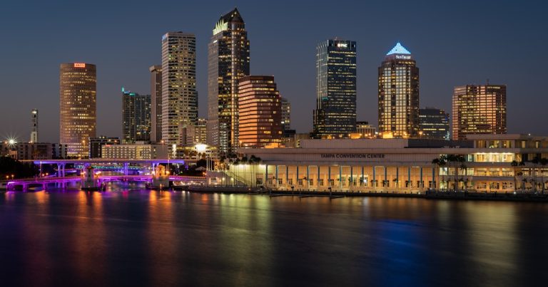
Pinellas County is a peninsula within a peninsula, with water on three sides: Tampa Bay to the east, Boca Ciega Bay in the middle, and the Gulf of Mexico to the west. That geography creates a unique set of flood risks that most inland counties don’t face.
Average elevation across the county sits around 15 to 20 feet above sea level. Many neighborhoods, particularly along the coast and on barrier islands, sit at just 5 to 10 feet. When a tropical system pushes storm surge into Tampa Bay, that water has very few places to drain.
Hurricane Helene in 2024 showed the Tampa Bay region exactly what storm surge can do. Pinellas County’s barrier islands took significant damage, and neighborhoods along the bay experienced flooding that hadn’t been seen in decades. It was a wake-up call for anyone who assumed “it won’t happen here.”
On top of storm surge, Pinellas deals with king tides and sunny-day flooding in low-lying areas like Shore Acres in St. Petersburg and parts of Gulfport. Sea levels in Tampa Bay have risen approximately 8 inches since 1950, and projections estimate another 1 to 2 feet by 2060. That baseline rise makes every storm event worse.
What Does Flood Insurance Cost in Pinellas County?
Flood insurance costs in Pinellas County vary widely depending on your zone, elevation, distance to water, and the property’s replacement cost. Here are general annual premium ranges under FEMA’s current Risk Rating 2.0 system:
| Zone | Typical Annual Premium |
|---|---|
| X (minimal risk) | $400 to $800 |
| AE (inland, elevated) | $800 to $2,500 |
| AE (coastal, low elevation) | $2,000 to $6,000 |
| VE (barrier islands) | $3,000 to $12,000+ |
The National Flood Insurance Program (NFIP) caps residential coverage at $250,000 for the structure and $100,000 for contents. If your Pinellas County home is worth more than that, and many Tampa Bay waterfront properties are, you’ll need a private flood policy for the gap.
Private flood insurance has become a real option in Florida. Since 2019, Florida law allows private flood policies to satisfy lender requirements. Carriers like Neptune Flood, Wright Flood, and Palomar often offer higher coverage limits and sometimes lower premiums for lower-risk properties. Always confirm with your lender that they’ll accept a private policy before binding it.
New NFIP policies are priced immediately at full Risk Rating 2.0 rates. Existing policyholders see annual increases capped at 18% until they reach the full actuarial rate. If you’re buying a home with an existing NFIP policy, that policy can transfer to you at closing, which sometimes means inheriting a lower premium.
How Does FEMA’s Risk Rating 2.0 Affect Pinellas Homeowners?
Risk Rating 2.0, rolled out in October 2021, changed how FEMA prices flood insurance. Instead of basing your premium primarily on the flood zone printed on the map, FEMA now factors in your property’s specific distance to a flood source, the type of flood source (river, ocean, lake), your elevation, your home’s replacement cost, and historical flood frequency.
For Pinellas County homeowners, this means two properties on the same street can have very different premiums. A home elevated 3 feet above the BFE will pay significantly less than a neighbor at grade, even though both sit in Zone AE.
Some Zone X properties in Pinellas saw premium increases under Risk Rating 2.0, particularly those close to bayfront areas that were previously priced as minimal risk. On the flip side, some well-elevated homes in mapped flood zones saw their premiums decrease. The system is more granular, which is ultimately more fair, but it creates sticker shock for properties that were previously underpriced for their actual risk.
What Is an Elevation Certificate and Do You Need One?
An elevation certificate is a document prepared by a licensed surveyor that records your property’s elevation relative to the base flood elevation on the FEMA map. It costs between $200 and $500 in the Tampa Bay area.
Under Risk Rating 2.0, an elevation certificate is no longer required to get a flood insurance quote. But it can still save you money if it shows your property sits above the BFE. It also creates a paper trail for future buyers and may qualify your property for a Letter of Map Amendment (LOMA) from FEMA, which officially reclassifies your parcel out of the high-risk flood zone.
Pinellas County’s Building Department may already have elevation certificates on file for properties that were built or substantially improved in a flood zone. It’s worth checking before paying a surveyor for a new one.
What Are Florida’s Flood Disclosure Requirements?
Florida has strengthened flood disclosure laws significantly. As of July 2024, sellers of residential property must disclose to buyers whether the property is in a Special Flood Hazard Area, whether the seller currently carries flood insurance, any flood insurance claims filed on the property, and any known history of flooding.
This applies even in as-is contracts. The Florida Supreme Court’s Johnson v. Davis ruling established that sellers must disclose known material facts, and flooding history clearly qualifies. Buyers can also request a CLUE (Comprehensive Loss Underwriting Exchange) report to see past insurance claims on the property.
As a buyer, don’t rely solely on what the seller discloses. Run the FEMA map lookup yourself, ask your insurance agent for a flood quote early in the process, and ask neighbors about the area’s flood history. In a county like Pinellas, this due diligence isn’t optional.
What Should Buyers Know Before Purchasing in a Flood Zone?

Buying in a Pinellas County flood zone isn’t a dealbreaker. Thousands of families live happily in flood-designated areas. But you need to go in with open eyes and a clear budget.
Get a flood insurance quote before you make an offer. The premium is a real carrying cost that belongs in your monthly budget alongside the mortgage, taxes, and HOA. I’ve seen buyers fall in love with a waterfront home and then discover the flood insurance is $8,000 a year. That changes the math.
Look at the property’s elevation relative to the base flood elevation. A home built 2 feet above the BFE is in a fundamentally different risk position than one at grade, even if both are in Zone AE. Ask the seller for an elevation certificate or budget $300 to $500 to get your own.
Understand Pinellas County’s building codes for flood zones. Homes built or substantially renovated after the county adopted its current floodplain ordinances must meet specific elevation and construction standards. Older homes may not. That doesn’t disqualify them, but it affects both insurance pricing and long-term resilience.
Factor in resale. Flood zone properties can appreciate well, especially waterfront homes across Tampa Bay. But buyers in the next cycle will ask the same questions you’re asking now. A property with a clean flood history, good elevation, and transferable insurance is an easier sell down the road.
Navigating Flood Zones? Let’s Talk Before You Buy.
I help buyers understand flood risk, insurance costs, and property values across Pinellas County. Get honest guidance before you commit.
(813) 733-7907 [email protected]Frequently Asked Questions About Pinellas County Flood Zones
Is all of Pinellas County in a flood zone?
Not all, but most. Approximately 50 to 60 percent of Pinellas County falls within a FEMA Special Flood Hazard Area (high-risk zones A, AE, V, VE). When you include moderate-risk Zone X (shaded), roughly 75 to 80 percent of the county carries some level of mapped flood risk.
Do I need flood insurance if I’m in Zone X in Pinellas County?
It’s not required by your lender in Zone X, but it’s strongly recommended. About 25 to 30 percent of all NFIP flood claims nationwide come from Zone X properties. In Pinellas County, where the terrain is flat and drainage is slow, the risk in Zone X is higher than in many other parts of the country.
How do I find the flood zone for a specific address in Pinellas County?
Visit the FEMA Flood Map Service Center at msc.fema.gov and enter the address. You can also use the Pinellas County GIS portal at egis.pinellas.gov to view flood zone overlays on an interactive map.
Can I get a property removed from a FEMA flood zone?
Yes, if your property’s elevation is at or above the base flood elevation. You’ll need an elevation certificate from a licensed surveyor, then submit a Letter of Map Amendment (LOMA) application to FEMA. If approved, the property is officially reclassified, and mandatory flood insurance requirements are removed.
Does flood zone designation affect property values in Pinellas County?
It depends. Waterfront and barrier island properties in VE zones command premium prices because of their location, despite higher insurance costs. For non-waterfront properties, a high-risk flood zone can reduce buyer interest and may slightly lower offers. The key factor is whether the home is well-elevated and properly insured.
Are FEMA flood maps being updated for Pinellas County?
Yes. FEMA has been conducting updated coastal flood studies for the Tampa Bay region using improved storm surge modeling and sea level rise projections. Preliminary maps for portions of Pinellas County have been released for public review. When finalized, some properties may be reclassified into higher or lower risk zones.
Sources
- FEMA Flood Map Service Center (msc.fema.gov)
- Pinellas County Flood Information (pinellas.gov/flood)
- FEMA Risk Rating 2.0 (fema.gov/flood-insurance/risk-rating)
- Florida Statute 627.7142, Flood Insurance Disclosure