Crystal Beach FL (ZIP 34681) is approximately 5 to 10 minutes from downtown Dunedin, 15 to 20 minutes from downtown Clearwater, 10 to 15 minutes from Palm Harbor, and 40 to 50 minutes from downtown Tampa via the Courtney Campbell Causeway off-peak. US-19 is the main south corridor but experiences significant congestion during peak hours. Alt US-19 (CR-1) runs parallel and closer to Crystal Beach. PSTA bus service operates on CR-1. The Pinellas Trail gives cyclists a car-free route throughout North Pinellas County.
Crystal Beach FL Location and Road Network
Crystal Beach sits on the Gulf-facing side of North Pinellas County, ZIP code 34681, nestled between the city of Dunedin to the south and the community of Ozona to the north. Its location is one of the most appealing aspects of the community from a commuting perspective: it is far enough from the urbanized core of Clearwater to feel like a quiet coastal retreat, but close enough to the major employment centers of Pinellas County that daily commuting is practical for most professionals.
The community is not on a major arterial road. Alt US-19, also known as County Road 1 (CR-1) and locally called Bayshore Blvd in some sections, is the main north-south road that runs through or near Crystal Beach. This is the same road that connects Dunedin to Ozona and continues north toward Tarpon Springs. US-19 itself runs roughly a mile to the east and is the primary regional thoroughfare connecting North Pinellas County to Clearwater, St. Petersburg, and eventually to the Tampa Bay bridges.
For buyers who commute by car, Crystal Beach's position on the western side of Pinellas County creates a specific geographic reality: you are far from the major employment centers in south St. Petersburg, south Clearwater, or downtown Tampa if you need to cross the bay by bridge during peak hours. But you are very close to North Pinellas employment nodes in Palm Harbor, Dunedin, and Clearwater's northern areas, and manageable distances from central Clearwater and the Clearwater Beach area. For remote workers or those with flexible schedules, Crystal Beach's car-based accessibility is genuinely excellent.
Alt US-19 (CR-1) vs US-19: Which Route to Use
Alt US-19 (CR-1) is the road Crystal Beach residents use most for local trips and for accessing Dunedin and North Pinellas. It is a lower-speed surface road (typically 35 to 45 mph) with traffic signals, direct access to residential neighborhoods, and no controlled-access interchange system. For trips to downtown Dunedin, Ozona, or northern Clearwater, Alt US-19 is often the most direct route even though it is slower than US-19.
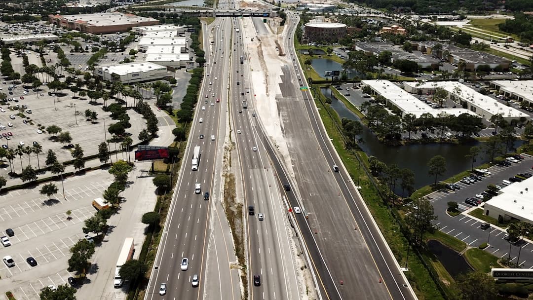
US-19 is the four-to-six-lane divided arterial that runs inland from Crystal Beach. Despite being the higher-capacity road, US-19 is one of the most congested routes in all of Pinellas County and has a poor safety record based on state and county transportation data. It functions as a pseudo-highway for regional north-south travel but is interrupted by frequent signalized intersections and lacks the grade-separated interchanges that would allow it to operate at expressway capacity. During morning and afternoon rush hours, US-19 through central and south Pinellas County is genuinely slow.
For Crystal Beach residents commuting south toward Clearwater or St. Petersburg, the typical strategy is to use Alt US-19 for local trips and to get on US-19 via one of the cross streets (Klosterman Road, Alderman Road, or others) when heading to destinations that require the regional arterial. The Dunedin Causeway, while primarily used for beach access, can also serve as a western routing option for drivers heading toward the Pinellas Bayway or Clearwater Beach corridor.
Key Navigation Points for Crystal Beach Commuters
New residents in Crystal Beach spend a few weeks learning the local road logic before it becomes intuitive. A few practical navigation notes: the community has limited east-west through roads, so getting from the Gulf side of the community to US-19 requires using specific cross streets. The Dunedin Causeway (heading south out of Crystal Beach toward Dunedin) connects to Causeway Boulevard which loops around to access US-19 and downtown Dunedin. For north trips toward Tarpon Springs and Pasco County, Alt US-19 north is direct. For south trips of any significant distance, planning which US-19 entry point to use based on real-time traffic conditions makes a meaningful difference in commute time.
Crystal Beach FL Commute Time Matrix
The table below shows typical drive times from Crystal Beach to major destinations in the Tampa Bay area. Off-peak times reflect mid-morning or mid-afternoon driving conditions. Peak times reflect typical weekday morning rush (7am to 9am) outbound or afternoon rush (4pm to 7pm) return conditions. All times assume normal weather and no incidents; Florida's frequent afternoon summer thunderstorms can add meaningful delays on US-19 and the bay bridges.
| Destination | Approx. Distance | Off-Peak Drive Time | Peak Drive Time | Primary Route |
|---|---|---|---|---|
| Downtown Dunedin | 3 to 5 miles | 5 to 10 min | 10 to 15 min | Alt US-19 south |
| Palm Harbor (downtown) | 5 to 8 miles | 10 to 15 min | 15 to 20 min | Cross street to US-19 or Alt US-19 |
| Downtown Clearwater | 12 to 15 miles | 15 to 20 min | 25 to 40 min | US-19 south |
| Tarpon Springs | 10 to 13 miles | 15 to 20 min | 20 to 25 min | Alt US-19 north or US-19 north |
| Pinellas Park | 20 to 25 miles | 25 to 35 min | 40 to 55 min | US-19 south |
| Largo | 18 to 22 miles | 20 to 30 min | 35 to 50 min | US-19 south |
| Downtown Tampa | 38 to 45 miles | 40 to 50 min | 55 to 75 min | US-19 south to SR-60 (Courtney Campbell) |
| Downtown St. Petersburg | 30 to 35 miles | 40 to 50 min | 50 to 70 min | US-19 south to I-275 south |
Commuting to Clearwater from Crystal Beach
Clearwater is the county seat of Pinellas County and one of the largest employment centers in the Tampa Bay area. The drive from Crystal Beach to downtown Clearwater is 12 to 15 miles and takes 15 to 20 minutes off-peak via US-19 south. During the morning rush hour, that same trip regularly runs 25 to 40 minutes, primarily because of signal congestion and merging traffic on US-19 through northern and central Clearwater.
Clearwater Beach, while not a major employment hub, is a popular destination for Crystal Beach residents and is accessible via the SR-60 causeway from downtown Clearwater, adding 10 to 15 minutes to the Clearwater commute for beach-adjacent employment or leisure. The Morton Plant Hospital complex and the Clearwater medical corridor along US-19 are significant employers that are 15 to 25 minutes from Crystal Beach depending on traffic.
For commuters to Clearwater, Crystal Beach's position north of Clearwater means you are generally driving against the heaviest traffic flows. The morning rush on US-19 in Pinellas is predominantly southbound, toward Clearwater and St. Petersburg employment centers, which means Crystal Beach residents heading south are in the primary commuter stream. Conversely, the evening return trip north is also somewhat congested but benefits from the dispersion of traffic across multiple routes once you get north of central Clearwater.
Commuting to Tampa from Crystal Beach FL
Tampa is the largest employment center in the broader Tampa Bay region, and it is a daily commute destination for a significant number of Crystal Beach residents. The realities of that commute deserve honest treatment: it is a long commute by most measures, particularly during peak hours.
The Courtney Campbell Causeway Route
The most common route from Crystal Beach to downtown Tampa runs south on US-19 to State Road 60 (Courtney Campbell Causeway) in Clearwater, then east across Tampa Bay on the Courtney Campbell to reach Tampa. The Courtney Campbell Causeway is a two-lane divided highway over water, and it is one of three major bay crossings in the Tampa Bay region. Off-peak, the full trip from Crystal Beach to downtown Tampa takes 40 to 50 minutes.
During peak hours, the Courtney Campbell is a significant bottleneck. The causeway has limited capacity and is a choke point that can back up considerably during the morning rush eastbound and the evening rush westbound. In bad traffic, the crossing itself can add 15 to 20 minutes beyond the off-peak time, making the full Crystal Beach to Tampa commute run 55 minutes to over an hour regularly during the work week. This is a real consideration for buyers who will be making that drive five days a week.
The Howard Frankland Bridge Route
An alternative for Tampa commuters is US-19 south to I-275 south in St. Petersburg, then north on I-275 over the Howard Frankland Bridge to Tampa. This route is longer in distance but uses higher-capacity interstate infrastructure. During certain peak periods, particularly when the Courtney Campbell is badly backed up, the Howard Frankland route can be faster. However, it typically adds 5 to 10 miles to the total trip and goes through the southern part of Clearwater and St. Petersburg before reversing direction, which adds its own congestion exposure.
Crystal Beach residents who commute to Tampa daily typically use a combination of both routes, selecting based on real-time navigation app guidance (Google Maps and Waze are widely used for this purpose). The best commuters in North Pinellas develop a feel for which route is moving on a given day based on time of departure and weather conditions.
US-19 Traffic: The Honest Reality for Crystal Beach Commuters
US-19 is the defining transportation challenge of Pinellas County, and any honest commute guide for Crystal Beach has to address it directly. The Florida Department of Transportation has been working on US-19 improvements for decades, and some segments have been upgraded with continuous flow intersections (CFIs) that improve throughput at key intersections. But US-19 through the heart of Clearwater and south toward St. Petersburg remains a corridor with significant and predictable congestion during peak hours.
The segment of US-19 north of Crystal Beach, between Tarpon Springs and Palm Harbor, is less congested than the southern segments and is generally free-flowing except for isolated signal congestion. The segment south of Crystal Beach through Dunedin and into Clearwater is where traffic builds. By the time you reach the US-19 and SR-580 (Main Street) intersection in Dunedin heading south, the road is noticeably slower during rush hours.
For Crystal Beach residents, the practical mitigation strategies for US-19 traffic include: shifting commute departure times to avoid the worst congestion windows (leaving before 7am or after 9am in the morning; leaving after 6:30pm in the evening), using navigation apps that route around incident-related backups, and considering employers that allow flexible or remote work at least some days per week. Remote work has become a standard offering at many employers since 2020, and for Crystal Beach residents with Tampa-area jobs, even two or three days of remote work per week dramatically improves quality of life by reducing US-19 exposure.
Public Transit from Crystal Beach FL: PSTA Bus Service
Crystal Beach is served by the Pinellas Suncoast Transit Authority (PSTA), the county's public bus system. PSTA operates bus routes along the Alt US-19 (CR-1) corridor that runs through and near Crystal Beach. Route 73 and nearby routes provide connections northward toward Tarpon Springs and southward toward Dunedin and Clearwater, where PSTA's broader network connects to more routes and the Clearwater Ferry.
PSTA Bus Service: What It Offers and What It Doesn't
PSTA bus service from Crystal Beach is practical for riders commuting to Dunedin or central Clearwater without a car. Routes run at intervals of 30 to 60 minutes on the Alt US-19 corridor, which means PSTA is not a high-frequency rapid transit option. A rider commuting from Crystal Beach to downtown Clearwater by bus should expect a trip of 30 to 50 minutes depending on the number of stops and the wait time for connections, compared to 15 to 20 minutes by car off-peak.
For commuters to Tampa, PSTA alone does not offer a practical transit option. There is no direct bus or rail connection from Pinellas County to Tampa with meaningful frequency. The Pinellas Jolley Trolley serves a coastal route in the Dunedin to Clearwater Beach corridor but is oriented toward tourism rather than commuter service. PSTA does have connections to the Hillsborough Area Regional Transit (HART) system via the Clearwater transit hub, but a transit commute from Crystal Beach to Tampa via PSTA and HART would take two to three hours each way under current service conditions. This is not a realistic daily commute option for most people.
Pinellas County and the Tampa Bay region have discussed various regional transit improvements for many years, including BRT (bus rapid transit) corridors and light rail proposals. As of 2026, no new high-capacity transit connecting North Pinellas to Tampa has been funded or constructed. Buyers who are car-free or want to be car-free should be realistic: Crystal Beach is a car-dependent community for all practical purposes beyond local North Pinellas trips.
Biking and the Pinellas Trail: Crystal Beach's Best Commuter Asset
The Pinellas Trail is one of the genuinely exceptional assets of living in Crystal Beach. The trail is a 50-plus-mile paved, multi-use corridor that runs the length of Pinellas County from St. Petersburg in the south to Tarpon Springs in the north, largely following the former Seaboard Coast Line railroad right-of-way. The Pinellas Trail passes through or very near Crystal Beach, and it is one of the longest paved rails-to-trails conversions in the United States.
Using the Pinellas Trail for Commuting from Crystal Beach
For Crystal Beach residents who work in Dunedin, the Pinellas Trail is a genuine commuter asset. Dunedin's downtown is 5 to 10 minutes by car, and cycling the trail from Crystal Beach to Dunedin takes approximately 15 to 25 minutes for a fit cyclist, with no traffic, no parking hassles, and the bonus of getting exercise during the commute. Dunedin has made significant investments in trail connectivity to its downtown, including bike parking and amenities that make cycling a realistic daily option for cyclists heading to downtown jobs, the marina, or the Highland Games district.
For longer commutes on the trail, the path south toward Clearwater is entirely viable for athletic cyclists. Clearwater's downtown is 12 to 15 miles from Crystal Beach along the trail corridor, which translates to 45 to 60 minutes of cycling at a moderate pace. This is a realistic daily commute option only for very committed cyclists or e-bike riders. E-bikes have significantly expanded the practical commute range on the Pinellas Trail for North Pinellas residents, and the combination of a good e-bike and the trail infrastructure makes the Crystal Beach to downtown Clearwater cycling commute practical for a much larger segment of riders than traditional cycling alone.
The trail is also heavily used for recreation and fitness rather than commuting. Cycling, jogging, walking, and inline skating are all permitted and common. Morning and weekend use of the trail near Crystal Beach is busy, with a mix of serious road cyclists, families with children, dog walkers, and casual joggers. The community character of the trail, the way it connects Crystal Beach to Dunedin and to the broader North Pinellas community, is one of the lifestyle assets that Crystal Beach residents cite most frequently when explaining why they love where they live.
Pinellas Trail Safety and Conditions
The Pinellas Trail is generally safe and well-maintained. Pinellas County maintains the trail surface and lighting, and the trail has been improved significantly over the past decade with better pavement, more lighting on urban segments, and improved road crossing safety treatments. Like any shared multi-use path, conflicts between faster cyclists and slower pedestrians or walkers occur occasionally, but the trail is generally a welcoming and safe environment across the range of user types and ages.
Trail safety at road crossings requires attention. The trail crosses numerous streets at grade, some with traffic signals and some with stop signs that apply to trail users rather than to crossing vehicles. Cyclists and pedestrians should approach all crossings with caution, particularly at higher-traffic intersections. Pinellas County has improved many of the more dangerous crossings over the years, but situational awareness at crossings remains the individual user's responsibility.
The Dunedin Causeway: Getting to Honeymoon Island and Beyond
The Dunedin Causeway connects the Dunedin mainland to Honeymoon Island State Park at the northern end of the Pinellas County barrier island chain. From Crystal Beach, the causeway is approximately 10 to 15 minutes by car, and it is the primary road access to Honeymoon Island and to the passenger ferry that serves Caladesi Island.
The causeway itself is more than just a route to the park. It has a kayak launch, a shaded beach area popular with local families, and beautiful Gulf views. On weekends and Florida holidays, the causeway and the entrance to Honeymoon Island State Park can become congested and parking can fill up at the park. Crystal Beach residents have the advantage of proximity, making it easier to arrive early or to visit on less crowded weekday mornings when the park is significantly less busy.
For drivers using the causeway as a routing option to access Clearwater Beach or southern Pinellas County destinations, the route adds miles compared to US-19 and is not typically faster for those destinations. The causeway's value is primarily recreational for Crystal Beach residents rather than as a commuter routing option.
Evaluating Crystal Beach as a Place to Live and Commute?
Barrett Henry is a Broker Associate at REMAX Collective with 23+ years of real estate experience in North Pinellas County. I can help you evaluate how Crystal Beach fits your specific commute situation and lifestyle goals.
Contact Barrett Henry