Quick Answer
What flood zones exist in Nokomis FL and what do they mean for buyers?
Nokomis FL properties fall into three primary FEMA flood zone categories: Zone VE (coastal high-hazard on Casey Key Gulf side, highest risk, mandatory flood insurance required), Zone AE (100-year floodplain covering most waterfront and low-lying areas, mandatory flood insurance with federally backed mortgages), and Zone X (minimal flood risk in inland elevated areas, flood insurance optional). Check any property at msc.fema.gov. Contact Barrett Henry at (813) 733-7907 to discuss flood zone implications before making an offer.
Flood zone is one of the first things I tell buyers to check in Nokomis. It is not a formality. Hurricane Ian (September 2022) demonstrated exactly what FEMA's flood maps predict — surge water moved inland through the bays, the ICW, and the Gulf-front barrier islands in patterns that aligned closely with the flood zone boundaries. Properties in Zone AE and Zone VE were in the water. Properties in Zone X with good elevation were not.
The practical impact of flood zone for Nokomis buyers is: (1) whether flood insurance is required, (2) how much it costs, and (3) what elevation your new construction or addition must achieve. These are not abstractions — they directly affect your monthly payment and your ability to get a mortgage.
FEMA Flood Zone Categories in Nokomis FL
Zone VE — Coastal High-Hazard Area
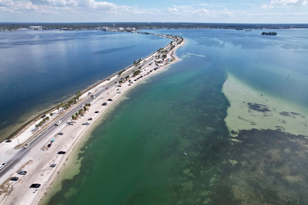
Zone VE is the most severe FEMA flood zone designation. In Nokomis, Zone VE applies primarily to the Gulf-front side of Casey Key and portions of Nokomis Beach park area. The 'V' stands for Velocity — these areas receive not just flooding but wave action during major storm events. New construction in Zone VE must use open-foundation design (pilings or columns) with breakaway walls below the first floor. Finished floor elevations must be at or above the Base Flood Elevation (BFE) plus freeboard. Existing structures may not meet current standards and face challenges with insurance and resale.
Flood insurance in Zone VE is mandatory for federally backed mortgages and is the most expensive tier. Private flood insurance quotes for Zone VE properties in Nokomis commonly run $8,000-$20,000 per year for the structure alone. Cash buyers sometimes purchase without flood insurance but this is a significant risk given the real storm history.
Zone AE — High-Risk, 100-Year Floodplain
Zone AE is the most common flood zone designation for Nokomis waterfront properties outside of the Gulf-direct zones. Zone AE means the area has a 1% annual chance of flooding (the so-called "100-year flood") and the Base Flood Elevation has been determined by engineering study. Roberts Bay waterfront homes, Blackburn Bay properties, and bay-side Casey Key are predominantly Zone AE.
Flood insurance is mandatory in Zone AE for federally backed mortgages (FHA, Fannie, Freddie, USDA, VA). NFIP coverage up to $250,000 for structure, $100,000 for contents. Annual premiums for Nokomis Zone AE properties run approximately $3,500-$12,000 depending on the elevation certificate and NFIP risk rating 2.0 calculation. Homes with higher elevation relative to BFE pay lower premiums.
Zone X — Minimal Flood Risk
Zone X covers areas outside the 500-year floodplain — the lowest-risk designation. Most inland Nokomis subdivisions away from the bay and creek systems are Zone X. Flood insurance is not required for federally backed mortgages in Zone X, though it is available and optional. Zone X is often incorrectly described as "out of the flood zone" — technically it means lower risk, not zero risk. Extreme rainfall events can cause localized flooding even in Zone X areas.
Zone X properties in Nokomis are clustered in the elevated inland areas east of US-41, particularly in the higher portions of Sorrento East, Sorrento South, and the Laurel Road corridor back from the bay system. Homeowners in these areas pay homeowner's insurance only (no mandatory flood premium), saving $4,000-$12,000 per year compared to AE zone neighbors.
Zone X500 — Moderate Risk
Some Nokomis areas fall in Zone X500 (shaded X on flood maps), which is the 500-year floodplain — moderate risk. Flood insurance is not required but is recommended. Properties in shaded X are generally in better shape than AE but still face some flood exposure.
How to Check the Flood Zone for Any Nokomis Property
The official source for flood zone information is FEMA's Flood Map Service Center at msc.fema.gov. Enter the property address and the site will show the applicable Flood Insurance Rate Map (FIRM) with the flood zone designation. The map also shows the effective date of the FIRM — Nokomis maps are periodically updated as conditions and study data change.
For a more precise determination, a licensed surveyor can produce a Letter of Map Amendment (LOMA) request if a property appears to be in a higher-risk zone but the actual grade elevation is above the BFE. A LOMA can remove a property from a mandatory purchase requirement if the lowest adjacent grade is at or above BFE.
Elevation Certificates and Flood Insurance Rates
An elevation certificate is a document prepared by a licensed surveyor that records the building's lowest floor elevation, lowest adjacent grade, and other measurements relative to the FIRM's base flood elevation. Insurance companies use the elevation certificate to price flood insurance — the higher your building is relative to BFE, the lower your premium.
For existing Nokomis homes, ask the seller for the elevation certificate if one exists. For waterfront properties, always commission a new elevation certificate from a licensed surveyor as part of your due diligence — cost is typically $300-$600. The savings in annual insurance premium can pay for the survey cost within weeks.
Flood Zone Impact on Nokomis Construction Requirements
Post-Hurricane Ian and Flood Zone Reality in Nokomis
Hurricane Ian made landfall on September 28, 2022, near Fort Myers. Even though the direct landfall was to the south, Ian's storm surge and wind impacts extended throughout Sarasota County. Nokomis waterfront properties on Roberts Bay and the ICW experienced flooding that aligned with AE zone predictions. Casey Key took wind damage and some surge impacts, though the island's Gulf-front properties fared better than many locations to the south due to the storm track.
Post-Ian, flood insurance costs increased substantially as NFIP updated its risk modeling under Risk Rating 2.0 (implemented October 2021 and phased in through 2022-2023). Properties that had legacy low flood insurance premiums saw significant increases. Some homeowners saw flood insurance jump from $2,000/year to $8,000-$15,000/year as Risk Rating 2.0 caught up with actual risk. This insurance shock contributed to waterfront price corrections in 2023.
My Recommendations for Nokomis Flood Zone Due Diligence
Here is what I tell every buyer looking at waterfront or potentially flood-exposed properties in Nokomis: First, check the FEMA flood map before making an offer. Second, get an elevation certificate. Third, get flood insurance quotes from at least two providers — NFIP through an agent and at least one private flood insurer. Fourth, factor the full annual insurance cost into your budget. Fifth, if you are buying in Zone AE or VE, make sure you understand what Ian-like surge would look like at that specific elevation based on the elevation certificate reading.
Ready to Buy in Nokomis?
Barrett Henry — Broker Associate at REMAX Collective. 23+ years of real estate experience.
Contact Barrett(813) 733-7907Frequently Asked Questions About Nokomis FL Flood Zones
Is Nokomis FL in a flood zone?
Parts of Nokomis are in flood zones and parts are not. Waterfront properties on Roberts Bay, Blackburn Bay, and Casey Key are in FEMA Zone AE or Zone VE. Inland elevated properties are generally in Zone X, the low-risk designation. Check msc.fema.gov with the specific address.
What does Zone AE mean in Nokomis FL?
Zone AE means the property is in the 100-year floodplain with a mapped Base Flood Elevation. Flood insurance is mandatory for federally backed mortgages. Annual premiums for Nokomis AE properties run $3,500-$12,000 depending on the elevation certificate.
What does Zone VE mean in Nokomis FL?
Zone VE is the coastal high-hazard zone covering Gulf-front portions of Casey Key. It includes velocity wave action risk. New construction requires open foundation (pilings). Insurance is mandatory and expensive — commonly $8,000-$20,000+ per year.
How do I check the flood zone for a Nokomis property?
Go to msc.fema.gov, enter the property address, and the Flood Insurance Rate Map will show the zone designation. For precision, have a licensed surveyor produce an elevation certificate.
Did Nokomis FL flood during Hurricane Ian?
Hurricane Ian (September 2022) caused flooding in Nokomis waterfront areas, particularly along Roberts Bay and the ICW, consistent with Zone AE designations. Casey Key experienced wind damage and some surge. Inland Zone X properties generally remained dry.
What is an elevation certificate and why do I need one?
An elevation certificate documents the building's floor elevation relative to the FEMA Base Flood Elevation. Insurance companies use it to price flood insurance. A higher elevation means lower premiums. Commissioning one for $300-$600 can save thousands per year in insurance.
About Barrett Henry: Licensed Broker Associate at REMAX Collective. 23+ years of real estate experience serving Sarasota County, Hillsborough County, Manatee County, and the broader Tampa Bay area. Learn more or call (813) 733-7907.